

Sydney Opera House to Harbour Bridge


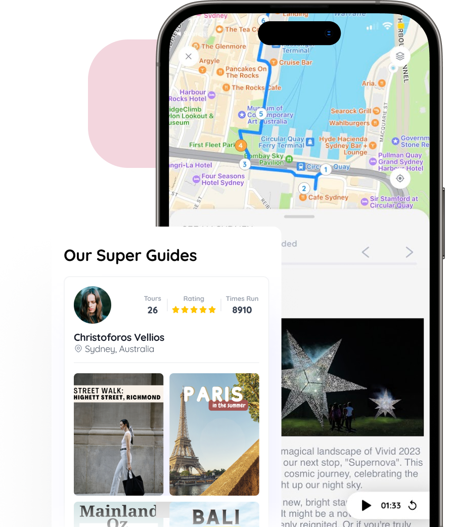
[{"address":"Sydney Opera House Circular Quay E,Sydney","location":{"longitudeDelta":0.004799525010071193,"latitudeDelta":0.005126849367421471,"latitude":-33.85733802139564,"longitude":151.2151436953107},"media":[{"metadata":{"width":564,"height":820},"type":"img","version":1,"content":"https://firebasestorage.googleapis.com/v0/b/freeguides-prod.appspot.com/o/assets%2Ftours%2FqXb8NyPTq1NXpkA3x5a1%2FNew%20Project%20(1).png?alt=media&token=8894200d-3c62-4656-bb53-ddaad9d1d641"},{"type":"audio","content":"https://firebasestorage.googleapis.com/v0/b/freeguides-prod.appspot.com/o/assets%2Ftours%2FqXb8NyPTq1NXpkA3x5a1%2Fstop_0_5.m4a?alt=media&token=4d7a316f-b93d-4418-86f5-dcbe1746412e"},{"type":"text","content":"#Sydney Opera House\n\nThe Sydney Opera House sits on Bennelong Point. Bennelong Point was named after Woollarawarre Bennelong, a senior Eora man at the time of the arrival of the British colonisers in Australia in 1788.\n\nThe opera house was opened by Queen Elizabeth II on 20th October, 1973. Construction began 14 years earlier and was only expected to take 4 years to build. \n\nThe designer, Jorn Utzon from Denmark won an international design competition in 1956 among 233 other hopeful entrants."},{"type":"link","content":"www.sydneyoperahouse.com"},{"metadata":{"width":1000,"height":993},"type":"img","version":1,"content":"https://firebasestorage.googleapis.com/v0/b/freeguides-prod.appspot.com/o/assets%2Ftours%2FqXb8NyPTq1NXpkA3x5a1%2Fstop_0_3.png?alt=media&token=f7db40d6-2750-4ab0-9881-62220298bc25"}]},{"address":"Circular Quay E Circular Quay E,Sydney","location":{"longitudeDelta":0.00479952501018488,"latitudeDelta":0.00512679742397637,"latitude":-33.85820327931494,"longitude":151.21575491693437},"media":[{"metadata":{"width":1000,"height":1001},"type":"img","version":1,"content":"https://firebasestorage.googleapis.com/v0/b/freeguides-prod.appspot.com/o/assets%2Ftours%2FqXb8NyPTq1NXpkA3x5a1%2Fstop_1_0.png?alt=media&token=aa52a4b0-186f-4899-9be1-53ed1d8f3241"},{"type":"audio","content":"https://firebasestorage.googleapis.com/v0/b/freeguides-prod.appspot.com/o/assets%2Ftours%2FqXb8NyPTq1NXpkA3x5a1%2Fstop_1_3.m4a?alt=media&token=73a3f01b-14a8-48a1-bc01-1ce59ee73133"},{"type":"text","content":"#Man O’War Steps\n\nThe Man O’War Steps is a heritage listed jetty located next to the Sydney Opera House.\n\nOn December 17, 1817, Governor Macquarie laid the foundation stone of the fort now bearing his name. In 1913, the jetty was taken over by the Royal Australian Navy and served as a landing and embarkation point for the men of British and Australian Fleets in peace and war.\n\nIn 1973, in conjunction with the erection of the Sydney Opera House, the stone jetty was restored."},{"metadata":{"width":1000,"height":1000},"type":"img","version":1,"content":"https://firebasestorage.googleapis.com/v0/b/freeguides-prod.appspot.com/o/assets%2Ftours%2FqXb8NyPTq1NXpkA3x5a1%2Fstop_1_3.png?alt=media&token=83f13b38-a47f-4dd3-80f5-14daf95b41e6"},{"metadata":{"width":1000,"height":1001},"type":"img","version":1,"content":"https://firebasestorage.googleapis.com/v0/b/freeguides-prod.appspot.com/o/assets%2Ftours%2FqXb8NyPTq1NXpkA3x5a1%2Fstop_1_4.png?alt=media&token=96f564ba-1a8b-4f1d-963f-bfda13007446"},{"metadata":{"width":1000,"height":1001},"type":"img","version":1,"content":"https://firebasestorage.googleapis.com/v0/b/freeguides-prod.appspot.com/o/assets%2Ftours%2FqXb8NyPTq1NXpkA3x5a1%2Fstop_1_5.png?alt=media&token=08f0879f-8aaf-4e8b-8760-efbbf2809cfd"},{"metadata":{"width":1000,"height":1001},"type":"img","version":1,"content":"https://firebasestorage.googleapis.com/v0/b/freeguides-prod.appspot.com/o/assets%2Ftours%2FqXb8NyPTq1NXpkA3x5a1%2Fstop_1_6.png?alt=media&token=18ae0584-6ef5-41f1-b3fd-69cbbd934acf"}]},{"address":"Tarpeian Way Tarpeian Way,Sydney","location":{"longitudeDelta":0.00479952501018488,"latitudeDelta":0.005126793947425767,"latitude":-33.85826119001356,"longitude":151.21445043083736},"media":[{"metadata":{"width":1000,"height":1000},"type":"img","version":1,"content":"https://firebasestorage.googleapis.com/v0/b/freeguides-prod.appspot.com/o/assets%2Ftours%2FqXb8NyPTq1NXpkA3x5a1%2Fstop_2_0.png?alt=media&token=44b0dc22-ee30-4c1e-a7e6-872dfee46a61"},{"type":"text","content":"#Sydney Writers Walk\n\nThe Sydney Writers Walk is a series of 60 circular metal plaques embedded in the footpath between the Sydney Opera House and the Overseas Passenger Terminal.\n\nThe plaques were installed to honour and celebrate the lives and works of well-known Australian writers, as well as notable authors who lived or visited Australia.\n\nThe walk was created by the NSW Ministry for the Arts in 1991."},{"type":"audio","content":"https://firebasestorage.googleapis.com/v0/b/freeguides-prod.appspot.com/o/assets%2Ftours%2FqXb8NyPTq1NXpkA3x5a1%2Fstop_2_3.m4a?alt=media&token=68281c74-db06-4663-bdd3-9bc69fed7a9e"},{"metadata":{"width":1000,"height":1000},"type":"img","version":1,"content":"https://firebasestorage.googleapis.com/v0/b/freeguides-prod.appspot.com/o/assets%2Ftours%2FqXb8NyPTq1NXpkA3x5a1%2Fstop_2_3.png?alt=media&token=04ef63b7-7fce-405c-9910-29ddbe02b3a4"}]},{"address":"5010 Circular Quay E Circular Quay E,Sydney","location":{"longitudeDelta":0.00479952501018488,"latitudeDelta":0.005126712554336166,"latitude":-33.85961696927623,"longitude":151.2130639013274},"media":[{"metadata":{"width":1000,"height":1000},"type":"img","version":1,"content":"https://firebasestorage.googleapis.com/v0/b/freeguides-prod.appspot.com/o/assets%2Ftours%2FqXb8NyPTq1NXpkA3x5a1%2Fstop_3_0.png?alt=media&token=ebcb26a5-312d-4dc8-a6d1-ba62732c1ed8"},{"type":"text","content":"#Original shoreline of Circular Quay\n\nCircular Quay was once a natural, rocky, intertidal shoreline of Garigalo (Saltwater) Country and was called Tubogwule which means “where the knowledge waters meet” as this is the point where freshwater met saltwater and created an excellent environment for fishing.\n\n"},{"type":"audio","content":"https://firebasestorage.googleapis.com/v0/b/freeguides-prod.appspot.com/o/assets%2Ftours%2FqXb8NyPTq1NXpkA3x5a1%2Fstop_3_3.m4a?alt=media&token=66189b18-0940-43e7-bbde-b99083b5a00a"}]},{"address":"Moore Steps Moore Steps,Sydney","location":{"longitudeDelta":0.004799525010014349,"latitudeDelta":0.005126659038374726,"latitude":-33.86050836684212,"longitude":151.21294542621553},"media":[{"metadata":{"width":1000,"height":1000},"type":"img","version":1,"content":"https://firebasestorage.googleapis.com/v0/b/freeguides-prod.appspot.com/o/assets%2Ftours%2FqXb8NyPTq1NXpkA3x5a1%2Fstop_4_0.png?alt=media&token=0c64a5ef-b2ad-4464-9304-69f34f164fc1"},{"type":"text","content":"#Moore Steps\n\nMoore steps are located on the east side of Sydney Cove and connect Circular Quay with Macquarie St. \n\nThe stairway is named in honour of the City Mayor at the time, Charles Moore, as a plaque in the landing wall attests.\n\nThe design was created by Edward Bell in 1868.\n\n#United Cinemas\n\nAlong this route you will also find the United Cinemas and various tourist shops, this is a great place for a coffee and some ice cream."},{"metadata":{"width":1000,"height":1001},"type":"img","version":1,"content":"https://firebasestorage.googleapis.com/v0/b/freeguides-prod.appspot.com/o/assets%2Ftours%2FqXb8NyPTq1NXpkA3x5a1%2Fstop_4_2.png?alt=media&token=8ea186e3-ee47-499f-b534-b8d53da1b6c2"}]},{"address":"First Fleet Park,Sydney","location":{"longitudeDelta":0.004799525010071193,"latitudeDelta":0.005126621343130466,"latitude":-33.86113623386832,"longitude":151.2093153588958},"media":[{"metadata":{"width":1000,"height":1001},"type":"img","version":1,"content":"https://firebasestorage.googleapis.com/v0/b/freeguides-prod.appspot.com/o/assets%2Ftours%2FqXb8NyPTq1NXpkA3x5a1%2Fstop_5_0.png?alt=media&token=31c2200e-a21b-45a7-9198-3926f15b2386"},{"type":"text","content":"#First Fleet Park\n\nFirst Fleet Park is situated between the Museum of Contemporary Art building and the Circular Quay transport interchange.\n\nThis public space contains both paved and grassed areas."},{"metadata":{"width":1000,"height":1001},"type":"img","version":1,"content":"https://firebasestorage.googleapis.com/v0/b/freeguides-prod.appspot.com/o/assets%2Ftours%2FqXb8NyPTq1NXpkA3x5a1%2Fstop_5_2.png?alt=media&token=46e6bc60-b8b7-40f6-8e34-6cd0acb7acf1"},{"metadata":{"width":1000,"height":1000},"type":"img","version":1,"content":"https://firebasestorage.googleapis.com/v0/b/freeguides-prod.appspot.com/o/assets%2Ftours%2FqXb8NyPTq1NXpkA3x5a1%2Fstop_5_3.png?alt=media&token=a9dcf3f8-fb71-46b3-ba69-2702548c7b63"}]},{"address":"68 Harrington Street Harrington Street,The Rocks","location":{"longitudeDelta":0.0014577715646169054,"latitudeDelta":0.0015571309664892397,"latitude":-33.860608363613736,"longitude":151.2081257744726},"media":[{"metadata":{"width":1000,"height":999},"type":"img","version":1,"content":"https://firebasestorage.googleapis.com/v0/b/freeguides-prod.appspot.com/o/assets%2Ftours%2FqXb8NyPTq1NXpkA3x5a1%2Fstop_6_0.png?alt=media&token=4516a3ed-992c-4c71-8ab3-380d913ac544"},{"type":"text","content":"#Nurses Walk\n\nHeading towards the laneways, the nurses walk is a series of hidden laneways between the historic buildings in the rocks.\n\nStart by walking up towards endota spa. And head through the maze to discover a range of shops and cafes.\n\nAllow yourself to get lost and emerge in the streets following the exploration."},{"metadata":{"width":1000,"height":1001},"type":"img","version":1,"content":"https://firebasestorage.googleapis.com/v0/b/freeguides-prod.appspot.com/o/assets%2Ftours%2FqXb8NyPTq1NXpkA3x5a1%2Fstop_6_2.png?alt=media&token=078e401c-f699-42a9-ad04-b5ca42cabf7d"},{"metadata":{"width":1000,"height":1000},"type":"img","version":1,"content":"https://firebasestorage.googleapis.com/v0/b/freeguides-prod.appspot.com/o/assets%2Ftours%2FqXb8NyPTq1NXpkA3x5a1%2Fstop_6_3.png?alt=media&token=39a3a27e-4a79-4e11-8e12-e3689cd85fae"},{"metadata":{"width":1000,"height":1001},"type":"img","version":1,"content":"https://firebasestorage.googleapis.com/v0/b/freeguides-prod.appspot.com/o/assets%2Ftours%2FqXb8NyPTq1NXpkA3x5a1%2Fstop_6_4.png?alt=media&token=cecea967-fc1a-4118-8b18-bfa93aa1de19"},{"metadata":{"width":1000,"height":1001},"type":"img","version":1,"content":"https://firebasestorage.googleapis.com/v0/b/freeguides-prod.appspot.com/o/assets%2Ftours%2FqXb8NyPTq1NXpkA3x5a1%2Fstop_6_5.png?alt=media&token=07386690-c829-4925-a396-522b1ba0b0f8"},{"metadata":{"width":1000,"height":1001},"type":"img","version":1,"content":"https://firebasestorage.googleapis.com/v0/b/freeguides-prod.appspot.com/o/assets%2Ftours%2FqXb8NyPTq1NXpkA3x5a1%2Fstop_6_6.png?alt=media&token=54db9b04-540b-44a1-89fb-b62d704c8a7a"}]},{"address":"Suez Canal Suez Canal,The Rocks","location":{"longitudeDelta":0.0014577715646169054,"latitudeDelta":0.0015571507575771193,"latitude":-33.859523020941154,"longitude":151.20815318554287},"media":[{"metadata":{"width":1000,"height":1000},"type":"img","version":1,"content":"https://firebasestorage.googleapis.com/v0/b/freeguides-prod.appspot.com/o/assets%2Ftours%2FqXb8NyPTq1NXpkA3x5a1%2Fstop_7_0.png?alt=media&token=ce91e00c-fc35-4136-bf67-0b392f0e5e1e"},{"type":"text","content":"#The Rocks Ghost Tour\n\nFancy some additional tours at night? \n\nThe Rocks Ghost Tours was established in 1994. They are the leading ghost tour in Sydney, NSW, and probably Australia. They have exclusive access to many “off limits” locations where you can be led into the dim half-light of some of the most haunted places in Sydney. Our guides and researchers are real historians, and our tours are based on historical documentation and information that has been handed down through generations of local residents.\n\nThe Rocks Ghost tours were created to explore the darker side of the Rocks that many people have never known about. This area has been inundated with a history that is fun, fascinating, tragic and strange. Come join us on the Dark North or the Dark South tour for a life changing experience as well delve into the macabre and haunted houses in the birthplace of Sydney, The Rocks. with a touch of the bizarre and the theatrical.\n\nThere is a cost to this ranging from $45 for adults"},{"type":"link","content":"https://www.ghosttours.com.au"},{"metadata":{"width":1000,"height":1000},"type":"img","version":1,"content":"https://firebasestorage.googleapis.com/v0/b/freeguides-prod.appspot.com/o/assets%2Ftours%2FqXb8NyPTq1NXpkA3x5a1%2Fstop_7_3.png?alt=media&token=fa91c335-65a7-4438-bf1b-59b131f1f19b"},{"metadata":{"width":1000,"height":1001},"type":"img","version":1,"content":"https://firebasestorage.googleapis.com/v0/b/freeguides-prod.appspot.com/o/assets%2Ftours%2FqXb8NyPTq1NXpkA3x5a1%2Fstop_7_4.png?alt=media&token=05074a85-810c-48cd-a5a5-ccb3c48e6ef0"}]},{"address":"Cambridge Street Cambridge Street,The Rocks","location":{"longitudeDelta":0.0014577715646169054,"latitudeDelta":0.0015571607617417271,"latitude":-33.858974378307174,"longitude":151.2072750924516},"media":[{"metadata":{"width":1000,"height":1001},"type":"img","version":1,"content":"https://firebasestorage.googleapis.com/v0/b/freeguides-prod.appspot.com/o/assets%2Ftours%2FqXb8NyPTq1NXpkA3x5a1%2Fstop_8_0.png?alt=media&token=c0c86fd8-3159-406d-a9ed-c10f4c9a1f10"},{"type":"text","content":"#The Argyle Stairs\n\nIt’s time to make our way up to the Sydney Harbour Bridge. Get those legs pumping as we have reached the ‘stairs’ part of our tour.\n\nArgyle Street was named by Gov. Macquarie after County Argyle, Scotland, the place where he grew up. In the early years of Sydney, The Rocks was a divided community separated by a rugged and steep rocky outcrop which forms the ridge of the peninsular to the west of Sydney Cove. Building had taken place on either side of the ridge, but people wishing to travel from one side to the other had to either go the long way around Dawes Point or climb a series of rickety stairs which joined the eastern and western sections of Argyle Street. Parts of Observation Hill near where Argyle Street intersects Kent Street was extensively quarried in the early 19th century.\n\nAs part of the improvements undertaken in The Rocks area by the Sydney Harbour Trust in 1911-12, Gloucester and Cumberland Streets were realigned, Argyle Cut was widened to 9 metres\n"},{"metadata":{"width":1000,"height":1000},"type":"img","version":1,"content":"https://firebasestorage.googleapis.com/v0/b/freeguides-prod.appspot.com/o/assets%2Ftours%2FqXb8NyPTq1NXpkA3x5a1%2Fstop_8_3.png?alt=media&token=6343150f-4521-4273-a368-39200d1ca2ec"},{"type":"text","content":"Two road bridges over the Argyle Cut replaced by a single bridge at Cumberland Street, and the Argyle Stairs were constructed. They replaced an early wooden set of stairs that gave access to Bunker \u0019s Hill, which was a high class residential area which sprang up along the top of the ridge which disappeared with the construction of the Sydney Harbour Bridge \u0019s southern approaches.\n\nArgyle Stairs today give access to Cahill Walk above Circular Quay beside the Cahill Expressway, and onto the walkway across the Sydney Harbour Bridge. \n"},{"metadata":{"width":1000,"height":1001},"type":"img","version":1,"content":"https://firebasestorage.googleapis.com/v0/b/freeguides-prod.appspot.com/o/assets%2Ftours%2FqXb8NyPTq1NXpkA3x5a1%2Fstop_8_4.png?alt=media&token=4c71c759-29c1-42f5-afc7-b4007f778043"},{"metadata":{"width":1000,"height":1001},"type":"img","version":1,"content":"https://firebasestorage.googleapis.com/v0/b/freeguides-prod.appspot.com/o/assets%2Ftours%2FqXb8NyPTq1NXpkA3x5a1%2Fstop_8_5.png?alt=media&token=4707cb41-f9c4-4695-8971-71abddbd734a"}]},{"address":"Foundation Park Gloucester Walk,The Rocks","location":{"longitudeDelta":0.0014577715646737488,"latitudeDelta":0.0015571728549730324,"latitude":-33.85831115981118,"longitude":151.2079877807342},"media":[{"metadata":{"width":1000,"height":1000},"type":"img","version":1,"content":"https://firebasestorage.googleapis.com/v0/b/freeguides-prod.appspot.com/o/assets%2Ftours%2FqXb8NyPTq1NXpkA3x5a1%2Fstop_9_0.png?alt=media&token=d3646c98-b027-4c15-9cb1-68be75548170"},{"type":"text","content":"#Foundation Park \n\nFoundation Park is a little known gem away from the main tourist area of The Rocks. Hidden behind a row of shops on Playfair Street, the site is made up of what were formerly No's 2-16 Gloucester Street, eight terrace houses constructed in the mid-1870s that were demolished in 1938.\n\nThe park was created on the site in 1972. Offering a unique opportunity to step back in time, it was landscaped to complement the adjoining Argyle Arts Centre in 1993-1996, with the foundations of the houses and sculptural interpretation incorporated into the park design. Visitors can walk through the ruins of the eight houses that were progressively built into a sandstone cliff face from 1874 to 1878. \n\nPerched on a steep, rocky hill, it is hard to imagine why anyone would build on such difficult land, but The Rocks was so densely populated during the 19th century that every spare piece of land was sought for housing."},{"metadata":{"width":1000,"height":1000},"type":"img","version":1,"content":"https://firebasestorage.googleapis.com/v0/b/freeguides-prod.appspot.com/o/assets%2Ftours%2FqXb8NyPTq1NXpkA3x5a1%2Fstop_9_2.png?alt=media&token=f17a6311-3738-4adf-9f47-945d91cdf0ad"},{"type":"text","content":"The rooms in the eight terrace houses were no larger than 3m x 3m, and demonstrate the cramped living conditions in the 19th century, compared to today. \n\nBack then, Sydney couples generally had between 4 and 10 children. When you walk around what’s left of the houses that stood in Foundation Park, you can imagine how difficult it would have been to accommodate such a large family in such small spaces. Many of the rooms are filled with models of 19th century furniture, which demonstrate how cramped living conditions really were. The furniture and other household goods give you a sense of how the rooms were used."},{"metadata":{"width":1000,"height":1001},"type":"img","version":1,"content":"https://firebasestorage.googleapis.com/v0/b/freeguides-prod.appspot.com/o/assets%2Ftours%2FqXb8NyPTq1NXpkA3x5a1%2Fstop_9_4.png?alt=media&token=138adf01-0bc6-490a-8dc6-9c1539455759"},{"metadata":{"width":1000,"height":1000},"type":"img","version":1,"content":"https://firebasestorage.googleapis.com/v0/b/freeguides-prod.appspot.com/o/assets%2Ftours%2FqXb8NyPTq1NXpkA3x5a1%2Fstop_9_5.png?alt=media&token=971ff4c0-467f-4e89-af05-9bf958f91b3f"}]},{"address":"Bradfield Highway Bradfield Highway,Millers Point","location":{"longitudeDelta":0.000519366678474853,"latitudeDelta":0.000554775973775179,"latitude":-33.85905604766032,"longitude":151.2067285119379},"media":[{"metadata":{"width":1000,"height":1000},"type":"img","version":1,"content":"https://firebasestorage.googleapis.com/v0/b/freeguides-prod.appspot.com/o/assets%2Ftours%2FqXb8NyPTq1NXpkA3x5a1%2Fstop_10_2.png?alt=media&token=80e7d399-d23b-4750-b4a8-e1e044618066"},{"type":"text","content":"#The Sydney Harbour Bridge\n\nThe Sydney Harbour Bridge is an Australian heritage-listed steel through arch bridge across Sydney Harbour that carries rail, vehicular, bicycle, and pedestrian traffic between the Sydney central business district (CBD) and the North Shore. The view of the bridge, the harbour, and the nearby Sydney Opera House is widely regarded as an iconic image of Sydney, and of Australia itself. The bridge is nicknamed \"The Coathanger\" because of its arch-based design."},{"metadata":{"width":1000,"height":1001},"type":"img","version":1,"content":"https://firebasestorage.googleapis.com/v0/b/freeguides-prod.appspot.com/o/assets%2Ftours%2FqXb8NyPTq1NXpkA3x5a1%2Fstop_10_0.png?alt=media&token=f4955c93-0b1e-4717-8bf8-fb8da6e8e468"},{"type":"text","content":"Under the direction of John Bradfield of the New South Wales Department of Public Works, the bridge was designed and built by British firm Dorman Long of Middlesbrough (who based the design on their 1928 Tyne Bridge in Newcastle upon Tyne) and opened in 1932.\n\nHeritage photos courtesy of pylonlookout.com.au"},{"metadata":{"width":185,"height":185},"type":"img","version":1,"content":"https://firebasestorage.googleapis.com/v0/b/freeguides-prod.appspot.com/o/assets%2Ftours%2FqXb8NyPTq1NXpkA3x5a1%2Fstop_10_11.png?alt=media&token=9c22e732-7ab5-4764-8fae-9153e7a72c69"},{"metadata":{"width":1000,"height":1001},"type":"img","version":1,"content":"https://firebasestorage.googleapis.com/v0/b/freeguides-prod.appspot.com/o/assets%2Ftours%2FqXb8NyPTq1NXpkA3x5a1%2Fstop_10_4.png?alt=media&token=a2e6d302-ba4b-45a6-82f7-dced137f74de"},{"type":"text","content":"The bridge's general design, which Bradfield tasked the NSW Department of Public Works with producing, was a rough copy of the Hell Gate Bridge in New York City. This general design document, however, did not form any part of the request for tender, which remained sufficiently broad as to allow cantilever (Bradfield's original preference) and even suspension bridge proposals. \n\nThe design chosen from the tender responses was original work created by Dorman Long, who leveraged some of the design from their own Tyne Bridge which, though superficially similar, does not share the graceful flares at the ends of each arch which make the harbour bridge so distinctive."},{"metadata":{"width":1000,"height":1000},"type":"img","version":1,"content":"https://firebasestorage.googleapis.com/v0/b/freeguides-prod.appspot.com/o/assets%2Ftours%2FqXb8NyPTq1NXpkA3x5a1%2Fstop_10_6.png?alt=media&token=ecd9de23-beb4-40a8-9c65-50071782fb40"},{"type":"text","content":"It is the eighth longest spanning-arch bridge in the world and the tallest steel arch bridge, measuring 134 m (440 ft) from top to water level. It was also the world's widest long-span bridge, at 48.8 m (160 ft) wide, until construction of the new Port Mann Bridge in Vancouver was completed in 2012.\n\nThe Sydney Harbour Bridge went on to be added to the Australian National Heritage List on 19 March 2007 and to the New South Wales State Heritage Register on 25 June 1999."},{"metadata":{"width":1000,"height":1001},"type":"img","version":1,"content":"https://firebasestorage.googleapis.com/v0/b/freeguides-prod.appspot.com/o/assets%2Ftours%2FqXb8NyPTq1NXpkA3x5a1%2Fstop_10_8.png?alt=media&token=a30df053-35d6-46c4-a051-634961dab43c"},{"type":"text","content":"#Pylon Lookout\n\nStep back in time to relive the magic of the Sydney Harbour Bridge – from its beginnings, the planning and construction, to the excitement of the opening ceremony and the celebration felt by the people of Sydney, and enjoy panoramic views of the Harbour from the original Sydney city Lookout.\n\nThis entrance attracts a cost of about $20 per adult."},{"type":"link","content":"https://pylonlookout.com.au"},{"type":"text","content":"#Choose your adventure\n\nTo finish the tour. You can walk south on the Cahill Expressway, follow this road and it will take you directly to Circular Quay.\n\nOr take the north pathway and walk across Sydney Harbour Bridge to Milson’s Point Train Station (Recommended)"}]}]
- Self-Guided experience
- Run anytime, anywhere, 24/7, with your own phone
- Self-Guided experience
- Additional expenses such as food and drink
- Transport
I enjoy playing Pokémon and Geocaching to explore amazing areas. I have a beautiful little sausage dog who likes to help me wander around finding new experiences.

I enjoy playing Pokémon and Geocaching to explore amazing areas. I have a beautiful little sausage dog who likes to help me wander around finding new experiences.

Use your phone to explore a new city or your own home town.

You’re the boss. Start the experience virtually or at the start location. Initiate at a time that works for you.

Each experience is hand made by a real local or organisation who is uniquely knowledgeable.

Connecting travellers and local guides who create self-guided tours of their city. Allows users to discover hidden gems, delve into local history, and pay what they want.
Subscribe to Our Newsletter
Follow us on


.svg)
.svg)
.svg)
.svg)
Copyrights ©2023 FreeGuides. All rights reserved.