


Super Tour
Ultimate Guide to Lake Oberon
bgfucOlg6WUjqNZibLbXTRL8tC02
Ultimate Guide to Lake Oberon
This guide will give you all the information you need before heading to Lake Oberon plus tips and tricks only locals know!
moreThis guide will give you all the information you need before heading to Lake Oberon plus tips and tricks only locals know!
["https://firebasestorage.googleapis.com/v0/b/freeguides-prod.appspot.com/o/assets%2Ftours%2FI3doUHf5DDM7W4MCoS5L%2FTHE%20ULTIMATE%20GUIDE%20TO%20LAKE%20OBERON.png?alt=media&token=135c2477-9d96-46b0-9992-1f372dfaf6f3","https://firebasestorage.googleapis.com/v0/b/freeguides-prod.appspot.com/o/assets%2Ftours%2FI3doUHf5DDM7W4MCoS5L%2F47573676_1809222305870568_6039416169335619584_n.jpg?alt=media&token=5871ed61-19e1-4644-8944-e1276afe8235","https://firebasestorage.googleapis.com/v0/b/freeguides-prod.appspot.com/o/assets%2Ftours%2FI3doUHf5DDM7W4MCoS5L%2FOberon%20Dam.jpg?alt=media&token=cc8b7d12-1418-4b0b-8edc-b5b7312b1060"]


No items found.
["https://firebasestorage.googleapis.com/v0/b/freeguides-prod.appspot.com/o/assets%2Ftours%2FI3doUHf5DDM7W4MCoS5L%2FTHE%20ULTIMATE%20GUIDE%20TO%20LAKE%20OBERON.png?alt=media&token=135c2477-9d96-46b0-9992-1f372dfaf6f3","https://firebasestorage.googleapis.com/v0/b/freeguides-prod.appspot.com/o/assets%2Ftours%2FI3doUHf5DDM7W4MCoS5L%2F47573676_1809222305870568_6039416169335619584_n.jpg?alt=media&token=5871ed61-19e1-4644-8944-e1276afe8235","https://firebasestorage.googleapis.com/v0/b/freeguides-prod.appspot.com/o/assets%2Ftours%2FI3doUHf5DDM7W4MCoS5L%2FOberon%20Dam.jpg?alt=media&token=cc8b7d12-1418-4b0b-8edc-b5b7312b1060"]
[{"address":"Oberon Dam","location":{"longitudeDelta":0.14321712068773834,"latitudeDelta":0.09219986310369421,"latitude":-33.72233040145549,"longitude":149.86595590229481},"media":[{"type":"text","content":"ABOUT\n\nOberon Dam is part of the Fish River water supply, the only scheme in eastern Australia to transfer western flowing water east of the Great Dividing Range. Conceived in the 1940s to supply water to the shale oil industry, it now supplies water to a nearby power station as well as meeting stock and domestic needs in the Oberon and Lithgow areas as well as the Blue Mountains. At 1068 meters above sea level, the lake is classed as alpine waters and is well-known for its great trout fishing. - Water NSW 2021"},{"type":"img","content":"https://firebasestorage.googleapis.com/v0/b/freeguides-prod.appspot.com/o/assets%2Ftours%2FI3doUHf5DDM7W4MCoS5L%2FDJI_0029_resized.JPG?alt=media&token=09e6b014-1fb9-4855-b65f-18d9bbd5b46e"},{"type":"text","content":"Opening hours:\nPicnic areas open during daylight hours, all year round. Entry is free. Oberon Visitor Information Centre 02 6329 8210."},{"type":"img","content":"https://firebasestorage.googleapis.com/v0/b/freeguides-prod.appspot.com/o/assets%2Ftours%2FI3doUHf5DDM7W4MCoS5L%2FOberon%20Dam.jpg?alt=media&token=87907c7d-8224-43c9-b070-335cc97f1412"},{"type":"link","content":"www.waternsw.com.au/supply/visit/oberon-dam"},{"type":"link","content":"www.maritime.nsw.gov.au"},{"type":"link","content":"www.statewater.com.au"},{"type":"link","content":"www.dpi.nsw.gov.au/fisheries"},{"type":"img","content":"https://firebasestorage.googleapis.com/v0/b/freeguides-prod.appspot.com/o/assets%2Ftours%2FI3doUHf5DDM7W4MCoS5L%2F131693031_3968041146655329_8362526359664294011_n.jpg?alt=media&token=1e1416eb-e4c3-4954-85c4-47ca0ca2c448"}]},{"address":"Kellys Lane","location":{"longitudeDelta":0.14321712068773834,"latitudeDelta":0.09219986310369421,"latitude":-33.729901774250855,"longitude":149.86419403071542},"media":[{"type":"text","content":"Both Rainbow and Brown trout can be found in the area. Lake Oberon is regularly stocked and both species can also be caught in the streams.\n\nLake Oberon is open to anglers all year round but the streams are subject to the Freshwater Fishing Regulations. The season for stream fishing opens at the start of the October long weekend and \ncloses at the end of the June long weekend. All anglers must have a Freshwater Fishing Licence. Exemptions apply to aboriginals, aged pensioners and anglers under 18 years of age, as well as private farm dams of 2 hectares or less. Fishing licences, tackle, bait, are available from various outlets in Oberon.\n\nLake Oberon supplies drinking water and therefore there are restrictions on recreational and other activities in the lake. Swimming is prohibited. Visitors may walk around the foreshore if they keep close to the waters edge. \n\nRecreational canoeing, kayaking and electric powered craft are accessible on Lake Oberon. The lake can be accessed from the Reef Reserve. The waters of Lake Oberon are classed as Alpine Waters and life vests must be worn. For further information please contact the Oberon Visitor Information Centre on 6329 8210.\n\nAccess to many of the streams in the area may be through private property—please remember that private property can only be entered with the prior permission of the landholder.\n"},{"type":"img","content":"https://firebasestorage.googleapis.com/v0/b/freeguides-prod.appspot.com/o/assets%2Ftours%2FI3doUHf5DDM7W4MCoS5L%2F60485294_2043761679083295_2734828568985993216_n.jpg?alt=media&token=f226cca6-9559-403b-9987-c29d40efdb75"},{"type":"text","content":"LAKE OBERON\nThere are 3 fishing spots: Kelly’s Bay, the Reef Reserve and the Oberon Dam Picnic Area and these are within easy reach of the town. Parking is available and public access to a variety of good fishing locations is available within easy walking distance. Oberon Dam Picnic Area is well signposted in the town. Fishing is not permitted on the dam wall but many excellent fishing spots can be found along the foreshore between the wall and the golf course (SW).\n\nKELLY’S BAY\nFollow the Edith Road towards Jenolan Caves (SE) approximately 5km from Oberon and turn right onto Shooters Hill Road. After travelling a short distance, turn right at the signposted Kelly’s Lane and continue along the unsealed road down to the lake.\n\nTHE REEF RESERVE\nTake the Abercrombie Road towards Black Springs and turn left on to the Reef Road 500m from Oberon. Partly unsealed to the reserve at the end.\n\n\nNetting is prohibited and any potential offenders are advised that a number of Honorary Environmental Officers now assist with surveillance. Fish may be caught at all times of the day, however early morning and late afternoon are best, as trout tend to feed at these times. All methods of legal fishing will yield results but seasonal considerations enter into the choice of equipment. The seasonal changes in the trout feeding habits are significant.\n\nBoth fly fishing and spinning for trout in Lake Oberon are permitted all year round. Effective lures are the Baltic Minnow, Salmon Devons, Celtas, Blade Lures, Tassie Devils, 2” to 2 1/2inch Rapalas, and all types of spoons, flashes, and plastic Jig Heads.\n\nThroughout the year it is also possible to use live bait (worms, mudeye etc) with a bubble. The use of frogs is prohibited. The choice of bait should follow the trout's feeding patterns at the fishing site. Bubble fishing using live bait is effective during the day and night. Anglers are reminded that they are restricted to two rods each with a line on the Lake and must be no more than 10m from your sight. Handline Fishing is prohibited. Local fly fishermen have their own special creations, but effective commercially available flies include: Black and Tan, Mrs Simpson, Hamill’s Killer, Muddler Minnow, Wooly Worm, Black Nymph, Fuzzy Wuzzy and many others. These are best for night-time whereas the nymphs are good for day fishing.\n\n"},{"type":"img","content":"https://firebasestorage.googleapis.com/v0/b/freeguides-prod.appspot.com/o/assets%2Ftours%2FI3doUHf5DDM7W4MCoS5L%2Fgolf%20sailing%20dam.JPG?alt=media&token=730f0594-7d48-463e-80fa-6e603261982f"},{"type":"text","content":"HISTORY \n\nFacts & History\nOberon Dam is situated on the Fish River about 3 kilometres south of Oberon on the NSW Central Tablelands. The dam is about 190 kilometres west of Sydney.\n\nOberon Dam has a capacity of 45,000 megalitres, making it a medium size but important water storage because of its role in the Fish River water supply scheme. This unique regional water supply scheme is the only one in eastern Australia to transfer western flowing water east of the Great Dividing Range.\n\nThe dam is one of only seven concrete slab and buttress dams in Australia, and of these dams has the highest wall and largest storage capacity.\n\nWhy the dam was built\nThe Fish River water supply scheme has its origins in chronic water supply problems in the towns of Lithgow, Wallerawang, Portland and Oberon as early as 1937, which were exacerbated by the 1940s drought. Small local schemes were rejected in favour of a regional scheme but funding delays stopped the start of works.\n\nWorld War II and the need for Australian-sourced fuel re-started the project in 1943 with an expanded scope to include water supply to the Glen Davis shale oil works. The early 1950s saw the closure of the shale oil works but the creation of new power stations for electricity generation at Wallerawang.\n\nToday the scheme supplies water to Wallerawang and Mount Piper power stations, to Oberon and Lithgow councils for domestic and industry use, and to more than 200 landholders along its length. It also supplements town supplies in the upper Blue Mountains.\n\nHow the dam was built\nOberon Dam’s original concrete slab and buttress wall was 21.3 metres high, although the foundations and buttress bases were built to allow later raising to its maximum design height of 33.5 metres.\n\nWork started in 1943 and was largely finished in 1947. Work continued until 1949 on completing stage 1 of the Fish River scheme, which included a 105-kilometre pipeline from the dam at Oberon through Wallerawang and Portland to Glen Davis, and a 15 kilometre branch pipeline from Wallerawang to Lithgow.\n\nStage 2 of the Fish River scheme included raising the Oberon Dam wall and outlet tower to its current height of 33.5 metres and building a ski jump spillway into the main wall.\n\nWork on the dam started in 1954 and finished in 1957. Work continued until 1959 on completing stage 2 of the Fish River scheme, which included additional small reservoirs at Rydal and Lidsdale, and a connection for the future pipeline to the Blue Mountains.\n\nLater improvements\nTo meet modern safety standards, in 1996 a fuse plug spillway was built just north of the wall to divert floodwaters around the dam in a rare and extreme flood so as to protect the dam and ensure it remains safe in an extreme flood. The dam's spillway channel had earlier been widened in 1989.\n\n- Water NSW 2021"},{"type":"img","content":"https://firebasestorage.googleapis.com/v0/b/freeguides-prod.appspot.com/o/assets%2Ftours%2FI3doUHf5DDM7W4MCoS5L%2F47573676_1809222305870568_6039416169335619584_n.jpg?alt=media&token=5c59176e-8c32-4d98-b3f8-03a87fc2beac"}]},{"address":"151 The Reef Rd","location":{"longitudeDelta":0.14321712068773834,"latitudeDelta":0.09219986310369421,"latitude":-33.71657976784861,"longitude":149.83215026181628},"media":[{"type":"img","content":"https://firebasestorage.googleapis.com/v0/b/freeguides-prod.appspot.com/o/assets%2Ftours%2FI3doUHf5DDM7W4MCoS5L%2Fhgjhgf.jpg?alt=media&token=48a90f7a-445b-4953-8d1c-5fb90059d4c2"},{"type":"text","content":"Oberon Dam/ Lake Oberon facts:\n\n- The dam wall is 34 METRES HIGH\n- Dam wall length is 232 METRES\n- Can hold 45 GL \nTOTAL OPERATING CAPACITY\nCatchment: 140 square kilometers"},{"type":"img","content":"https://firebasestorage.googleapis.com/v0/b/freeguides-prod.appspot.com/o/assets%2Ftours%2FI3doUHf5DDM7W4MCoS5L%2FGrazing%20Sheep%20by%20Lake%20Oberon%20-%20Nathan%20Taylor.jpg?alt=media&token=b4b5a365-5237-4a2b-938d-ab171497a3fa"}]},{"address":"48 Ross St","location":{"longitudeDelta":0.14321712068773834,"latitudeDelta":0.09219986310369421,"latitude":-33.708739842090374,"longitude":149.85764820868374},"media":[{"type":"text","content":"RIVER FISHING & NATIONAL PARKS:\nThe local streams, including National Parks, are famous for their trout. During times of low rainfall, the levels of these streams drop and this affects trout numbers and the methods of fishing that can be used.\nRecommended streams are:\n- Little River and Running Stream (on the Abercrombie Road 39km from Oberon)\n- Fish River at Tarana (23km from Oberon)\n- Fish River at O’Connell (on the O’Connell Road 19km from Oberon)\n- Campbells River at Black Springs (on the Campbells River Road 33km from Oberon)\n- Duckmaloi River at Duckmaloi (off the Duckmaloi Road approx. 13km from Oberon)\n- Kowmung River is situated in the beautiful Kanangra Boyd National Park offering camping, solitude, and spectacular scenery.\n"},{"type":"img","content":"https://firebasestorage.googleapis.com/v0/b/freeguides-prod.appspot.com/o/assets%2Ftours%2FI3doUHf5DDM7W4MCoS5L%2FRedfin%20roundup%202019%20fishing%20kayaks.jpg?alt=media&token=17a60ac2-20f2-421c-9d58-2096a0c10d4e"},{"type":"text","content":"Contact Information:\nOberon Visitor Information Centre 6329 8210 \n\nNSW Roads and Maritime Services 13 12 56\n\nState Water 1300 662 077\n\nNSW Department of Primary Industries \n- Angler Access 02 6042 4214\n- Bathurst Fisheries 02 6331 1428\n- Report Illegal Activity (free call) 1800 043 536\n\nIn an emergency call 000 or text 106"},{"type":"img","content":"https://firebasestorage.googleapis.com/v0/b/freeguides-prod.appspot.com/o/assets%2Ftours%2FI3doUHf5DDM7W4MCoS5L%2Ffdgfgfd.jpg?alt=media&token=8544346a-c772-4d57-ad6c-70a048539e06"},{"type":"link","content":"www.visitoberon.com"}]}]
4.00
0

Nature
4
hours
11
times run
#
115
Rank
This guide will give you all the information you need before heading to Lake Oberon plus tips and tricks only locals know!
4.0
Rating
Nature
4
Hours
11
TOURS COMPLETED
#
115
rank
≈
0 kms
Language
English
Start Location
Tags
This is some text inside of a div block.
On-tour Inclusion and Exclusion
Inclusions
Self-guided
Anytime, Anywhere
Creates by locals
Photo-taking assist
Video-taking assist
Exclusion
Drinking water
Sunglass and skin sunblock
Thank you! Your submission has been received!
Oops! Something went wrong while submitting the form.
9/25/2022

Cameron Wasilewsky
25
Sep
,
2022
4
4
Thank you! Your submission has been received!
Oops! Something went wrong while submitting the form.
Preview
[{"address":"Oberon Dam","location":{"longitudeDelta":0.14321712068773834,"latitudeDelta":0.09219986310369421,"latitude":-33.72233040145549,"longitude":149.86595590229481},"media":[{"type":"text","content":"ABOUT\n\nOberon Dam is part of the Fish River water supply, the only scheme in eastern Australia to transfer western flowing water east of the Great Dividing Range. Conceived in the 1940s to supply water to the shale oil industry, it now supplies water to a nearby power station as well as meeting stock and domestic needs in the Oberon and Lithgow areas as well as the Blue Mountains. At 1068 meters above sea level, the lake is classed as alpine waters and is well-known for its great trout fishing. - Water NSW 2021"},{"type":"img","content":"https://firebasestorage.googleapis.com/v0/b/freeguides-prod.appspot.com/o/assets%2Ftours%2FI3doUHf5DDM7W4MCoS5L%2FDJI_0029_resized.JPG?alt=media&token=09e6b014-1fb9-4855-b65f-18d9bbd5b46e"},{"type":"text","content":"Opening hours:\nPicnic areas open during daylight hours, all year round. Entry is free. Oberon Visitor Information Centre 02 6329 8210."},{"type":"img","content":"https://firebasestorage.googleapis.com/v0/b/freeguides-prod.appspot.com/o/assets%2Ftours%2FI3doUHf5DDM7W4MCoS5L%2FOberon%20Dam.jpg?alt=media&token=87907c7d-8224-43c9-b070-335cc97f1412"},{"type":"link","content":"www.waternsw.com.au/supply/visit/oberon-dam"},{"type":"link","content":"www.maritime.nsw.gov.au"},{"type":"link","content":"www.statewater.com.au"},{"type":"link","content":"www.dpi.nsw.gov.au/fisheries"},{"type":"img","content":"https://firebasestorage.googleapis.com/v0/b/freeguides-prod.appspot.com/o/assets%2Ftours%2FI3doUHf5DDM7W4MCoS5L%2F131693031_3968041146655329_8362526359664294011_n.jpg?alt=media&token=1e1416eb-e4c3-4954-85c4-47ca0ca2c448"}]},{"address":"Kellys Lane","location":{"longitudeDelta":0.14321712068773834,"latitudeDelta":0.09219986310369421,"latitude":-33.729901774250855,"longitude":149.86419403071542},"media":[{"type":"text","content":"Both Rainbow and Brown trout can be found in the area. Lake Oberon is regularly stocked and both species can also be caught in the streams.\n\nLake Oberon is open to anglers all year round but the streams are subject to the Freshwater Fishing Regulations. The season for stream fishing opens at the start of the October long weekend and \ncloses at the end of the June long weekend. All anglers must have a Freshwater Fishing Licence. Exemptions apply to aboriginals, aged pensioners and anglers under 18 years of age, as well as private farm dams of 2 hectares or less. Fishing licences, tackle, bait, are available from various outlets in Oberon.\n\nLake Oberon supplies drinking water and therefore there are restrictions on recreational and other activities in the lake. Swimming is prohibited. Visitors may walk around the foreshore if they keep close to the waters edge. \n\nRecreational canoeing, kayaking and electric powered craft are accessible on Lake Oberon. The lake can be accessed from the Reef Reserve. The waters of Lake Oberon are classed as Alpine Waters and life vests must be worn. For further information please contact the Oberon Visitor Information Centre on 6329 8210.\n\nAccess to many of the streams in the area may be through private property—please remember that private property can only be entered with the prior permission of the landholder.\n"},{"type":"img","content":"https://firebasestorage.googleapis.com/v0/b/freeguides-prod.appspot.com/o/assets%2Ftours%2FI3doUHf5DDM7W4MCoS5L%2F60485294_2043761679083295_2734828568985993216_n.jpg?alt=media&token=f226cca6-9559-403b-9987-c29d40efdb75"},{"type":"text","content":"LAKE OBERON\nThere are 3 fishing spots: Kelly’s Bay, the Reef Reserve and the Oberon Dam Picnic Area and these are within easy reach of the town. Parking is available and public access to a variety of good fishing locations is available within easy walking distance. Oberon Dam Picnic Area is well signposted in the town. Fishing is not permitted on the dam wall but many excellent fishing spots can be found along the foreshore between the wall and the golf course (SW).\n\nKELLY’S BAY\nFollow the Edith Road towards Jenolan Caves (SE) approximately 5km from Oberon and turn right onto Shooters Hill Road. After travelling a short distance, turn right at the signposted Kelly’s Lane and continue along the unsealed road down to the lake.\n\nTHE REEF RESERVE\nTake the Abercrombie Road towards Black Springs and turn left on to the Reef Road 500m from Oberon. Partly unsealed to the reserve at the end.\n\n\nNetting is prohibited and any potential offenders are advised that a number of Honorary Environmental Officers now assist with surveillance. Fish may be caught at all times of the day, however early morning and late afternoon are best, as trout tend to feed at these times. All methods of legal fishing will yield results but seasonal considerations enter into the choice of equipment. The seasonal changes in the trout feeding habits are significant.\n\nBoth fly fishing and spinning for trout in Lake Oberon are permitted all year round. Effective lures are the Baltic Minnow, Salmon Devons, Celtas, Blade Lures, Tassie Devils, 2” to 2 1/2inch Rapalas, and all types of spoons, flashes, and plastic Jig Heads.\n\nThroughout the year it is also possible to use live bait (worms, mudeye etc) with a bubble. The use of frogs is prohibited. The choice of bait should follow the trout's feeding patterns at the fishing site. Bubble fishing using live bait is effective during the day and night. Anglers are reminded that they are restricted to two rods each with a line on the Lake and must be no more than 10m from your sight. Handline Fishing is prohibited. Local fly fishermen have their own special creations, but effective commercially available flies include: Black and Tan, Mrs Simpson, Hamill’s Killer, Muddler Minnow, Wooly Worm, Black Nymph, Fuzzy Wuzzy and many others. These are best for night-time whereas the nymphs are good for day fishing.\n\n"},{"type":"img","content":"https://firebasestorage.googleapis.com/v0/b/freeguides-prod.appspot.com/o/assets%2Ftours%2FI3doUHf5DDM7W4MCoS5L%2Fgolf%20sailing%20dam.JPG?alt=media&token=730f0594-7d48-463e-80fa-6e603261982f"},{"type":"text","content":"HISTORY \n\nFacts & History\nOberon Dam is situated on the Fish River about 3 kilometres south of Oberon on the NSW Central Tablelands. The dam is about 190 kilometres west of Sydney.\n\nOberon Dam has a capacity of 45,000 megalitres, making it a medium size but important water storage because of its role in the Fish River water supply scheme. This unique regional water supply scheme is the only one in eastern Australia to transfer western flowing water east of the Great Dividing Range.\n\nThe dam is one of only seven concrete slab and buttress dams in Australia, and of these dams has the highest wall and largest storage capacity.\n\nWhy the dam was built\nThe Fish River water supply scheme has its origins in chronic water supply problems in the towns of Lithgow, Wallerawang, Portland and Oberon as early as 1937, which were exacerbated by the 1940s drought. Small local schemes were rejected in favour of a regional scheme but funding delays stopped the start of works.\n\nWorld War II and the need for Australian-sourced fuel re-started the project in 1943 with an expanded scope to include water supply to the Glen Davis shale oil works. The early 1950s saw the closure of the shale oil works but the creation of new power stations for electricity generation at Wallerawang.\n\nToday the scheme supplies water to Wallerawang and Mount Piper power stations, to Oberon and Lithgow councils for domestic and industry use, and to more than 200 landholders along its length. It also supplements town supplies in the upper Blue Mountains.\n\nHow the dam was built\nOberon Dam’s original concrete slab and buttress wall was 21.3 metres high, although the foundations and buttress bases were built to allow later raising to its maximum design height of 33.5 metres.\n\nWork started in 1943 and was largely finished in 1947. Work continued until 1949 on completing stage 1 of the Fish River scheme, which included a 105-kilometre pipeline from the dam at Oberon through Wallerawang and Portland to Glen Davis, and a 15 kilometre branch pipeline from Wallerawang to Lithgow.\n\nStage 2 of the Fish River scheme included raising the Oberon Dam wall and outlet tower to its current height of 33.5 metres and building a ski jump spillway into the main wall.\n\nWork on the dam started in 1954 and finished in 1957. Work continued until 1959 on completing stage 2 of the Fish River scheme, which included additional small reservoirs at Rydal and Lidsdale, and a connection for the future pipeline to the Blue Mountains.\n\nLater improvements\nTo meet modern safety standards, in 1996 a fuse plug spillway was built just north of the wall to divert floodwaters around the dam in a rare and extreme flood so as to protect the dam and ensure it remains safe in an extreme flood. The dam's spillway channel had earlier been widened in 1989.\n\n- Water NSW 2021"},{"type":"img","content":"https://firebasestorage.googleapis.com/v0/b/freeguides-prod.appspot.com/o/assets%2Ftours%2FI3doUHf5DDM7W4MCoS5L%2F47573676_1809222305870568_6039416169335619584_n.jpg?alt=media&token=5c59176e-8c32-4d98-b3f8-03a87fc2beac"}]},{"address":"151 The Reef Rd","location":{"longitudeDelta":0.14321712068773834,"latitudeDelta":0.09219986310369421,"latitude":-33.71657976784861,"longitude":149.83215026181628},"media":[{"type":"img","content":"https://firebasestorage.googleapis.com/v0/b/freeguides-prod.appspot.com/o/assets%2Ftours%2FI3doUHf5DDM7W4MCoS5L%2Fhgjhgf.jpg?alt=media&token=48a90f7a-445b-4953-8d1c-5fb90059d4c2"},{"type":"text","content":"Oberon Dam/ Lake Oberon facts:\n\n- The dam wall is 34 METRES HIGH\n- Dam wall length is 232 METRES\n- Can hold 45 GL \nTOTAL OPERATING CAPACITY\nCatchment: 140 square kilometers"},{"type":"img","content":"https://firebasestorage.googleapis.com/v0/b/freeguides-prod.appspot.com/o/assets%2Ftours%2FI3doUHf5DDM7W4MCoS5L%2FGrazing%20Sheep%20by%20Lake%20Oberon%20-%20Nathan%20Taylor.jpg?alt=media&token=b4b5a365-5237-4a2b-938d-ab171497a3fa"}]},{"address":"48 Ross St","location":{"longitudeDelta":0.14321712068773834,"latitudeDelta":0.09219986310369421,"latitude":-33.708739842090374,"longitude":149.85764820868374},"media":[{"type":"text","content":"RIVER FISHING & NATIONAL PARKS:\nThe local streams, including National Parks, are famous for their trout. During times of low rainfall, the levels of these streams drop and this affects trout numbers and the methods of fishing that can be used.\nRecommended streams are:\n- Little River and Running Stream (on the Abercrombie Road 39km from Oberon)\n- Fish River at Tarana (23km from Oberon)\n- Fish River at O’Connell (on the O’Connell Road 19km from Oberon)\n- Campbells River at Black Springs (on the Campbells River Road 33km from Oberon)\n- Duckmaloi River at Duckmaloi (off the Duckmaloi Road approx. 13km from Oberon)\n- Kowmung River is situated in the beautiful Kanangra Boyd National Park offering camping, solitude, and spectacular scenery.\n"},{"type":"img","content":"https://firebasestorage.googleapis.com/v0/b/freeguides-prod.appspot.com/o/assets%2Ftours%2FI3doUHf5DDM7W4MCoS5L%2FRedfin%20roundup%202019%20fishing%20kayaks.jpg?alt=media&token=17a60ac2-20f2-421c-9d58-2096a0c10d4e"},{"type":"text","content":"Contact Information:\nOberon Visitor Information Centre 6329 8210 \n\nNSW Roads and Maritime Services 13 12 56\n\nState Water 1300 662 077\n\nNSW Department of Primary Industries \n- Angler Access 02 6042 4214\n- Bathurst Fisheries 02 6331 1428\n- Report Illegal Activity (free call) 1800 043 536\n\nIn an emergency call 000 or text 106"},{"type":"img","content":"https://firebasestorage.googleapis.com/v0/b/freeguides-prod.appspot.com/o/assets%2Ftours%2FI3doUHf5DDM7W4MCoS5L%2Ffdgfgfd.jpg?alt=media&token=8544346a-c772-4d57-ad6c-70a048539e06"},{"type":"link","content":"www.visitoberon.com"}]}]
Included
- Self-Guided experience
- Run anytime, anywhere, 24/7, with your own phone
- Self-Guided experience
Excluded
- Additional expenses such as food and drink
- Transport
Meet Your Guide
Meet Your Guide
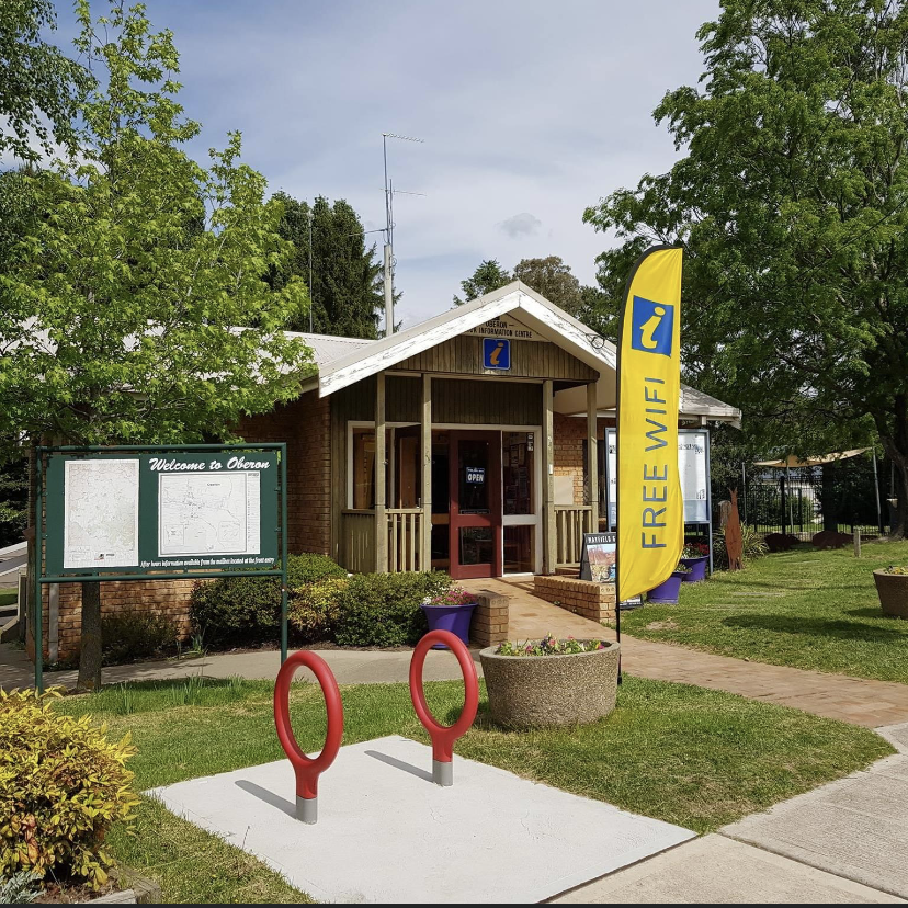
Oberon visitor information centre is located at 48 Ross street, Oberon, NSW. We are open everyday 9:30am - 5:00pm. You can contact us via phone 6329 8210 or email tourism@oberon.nsw.gov.au.
4
No items found.
Thank you! Your submission has been received!
Oops! Something went wrong while submitting the form.
Questions
No questions yet
Similar Experiences

Self-Guided
Use your phone to explore a new city or your own home town.

Anywhere Anytime
You’re the boss. Start the experience virtually or at the start location. Initiate at a time that works for you.

Created by local experts
Each experience is hand made by a real local or organisation who is uniquely knowledgeable.

Extend the relationship with your guests beyond the lobby and into the real world
Follow us on


.svg)
.svg)
.svg)
.svg)
Copyrights ©XXXX FreeGuides. All rights reserved.